Butte County Historical Society
Established 1956
Phone : 530 533-9418
Email us at buttehistory@sbcglobal.net
Documents From Our Collection

These documents were collected by The Butte County Historical Society while researching our local history. They are a great primary source that helps us understand how people existed and the efforts they made to establish and improve the areas where they settled. They represent the building blocks that help us understand those that came before us.
This section is organized by type and/or place.
Mining and Land Claims
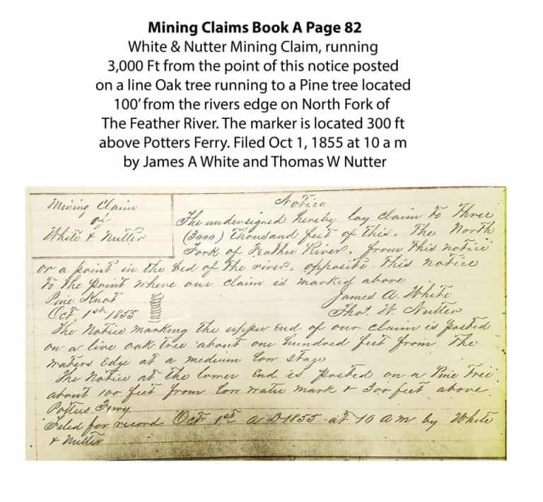
Prior to 1852 Mining Claims, Water Claims (many times to support mining efforts) and Land Claims were filed by posting handwritten claim notices at the site that was being claimed. The claim would reference a local landmark, preferably at 4 points to describe the site. Sometimes adjacent claims or streams were referenced to identify a location. This practice makes it nearly impossible to identify mining claims filed before 1852. Starting in 1852 these claim markers were reproduced in record books maintained by local authorities. The local authorities would then have the claims registered by the county authorities at a later date. The county would also reproduce the claim notices in their books. In 1862 it was decided to overlay boundary lines on a map describing four 160 acre square parcels each with a unique number and the township they were located in. The 160 acre parcels were later subdivided into lot numbers. The practice of defining land claims by Township, Section number and Lot numbers was quickly adopted after 1862. (Reference the 1886 map in the Map section for an example). Mining claims were much slower to adopt the system. It should be noted that many of the initial land claims in remote areas were not filed until the owner wanted to sell the property, in order to avoid taxes.
(Jarbo Gap Winds)